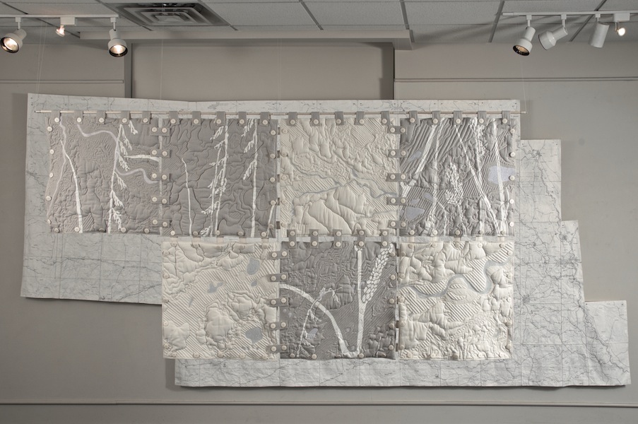
Terrain Squares
Locator Map and Terrain Squares, Haydon Installation (2010)
These 24” quilted relief forms show the physical terrain at a larger scale (1” = 596’). At this scale, boundaries are lost and only topography remains, with heights and depths expressed as contour lines and padded relief forms. Rivers, lakes and creeks, stitched in blue on the front, appear as white on the reverse, layering over a hand-stenciled fragment of a graphic of Nebraska grasses. Squares fasten together in any order with a system of buttons and tabs which echo the grid markings of the Locator Map. The Terrain Squares are made of organic cotton and a hemp/Tencel blend.


